


Destinations
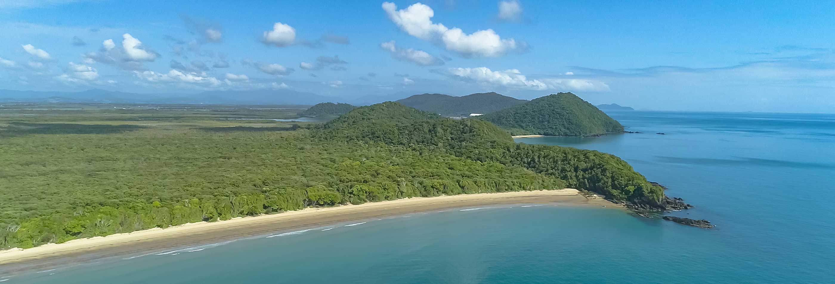
Our base of operation is Mourilyan Harbour, located within the Cassowary Coast region, Queensland, Australia. This coastal region beckons adventurers to explore its enchanting landscapes. Centered around the towns of Innisfail, Cardwell, and Tully, the region derives its name from the elusive and endangered cassowary, a feathered and flightless bird indigenous to the area.
Reef Navigator invites you to discover the hidden gems of this wonderful area, venturing to captivating destinations like the Barnard Island group, Dunk Island, Goold Island, Brook Island, and the islands west of Great Palm Island. Our tours are designed to cater to a diverse array of interests, ensuring a personalized experience that showcases the natural beauty and cultural richness of these remarkable locales.
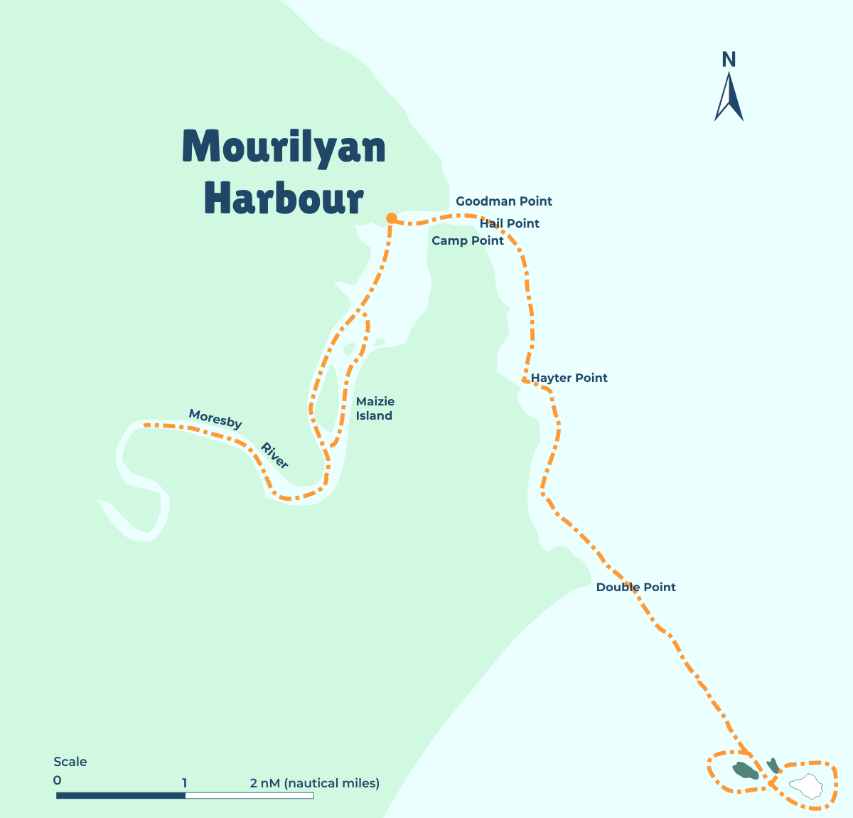
Mourilyan Harbour
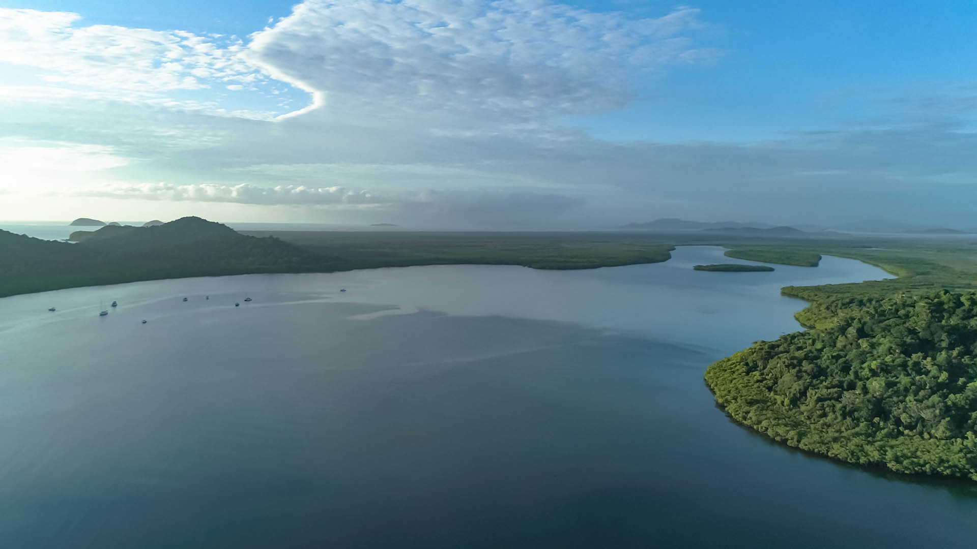
Mourilyan Harbour is a coastal locality and harbour within the Cassowary Coast Region, Queensland, Australia.
It is located approximately 2 hours south of Cairns and is known for its recreational fishing with many creeks and channels, lined with mangroves. Fish caught there include barramundi, mangrove jacks, giant trevally and queenfish. The port facility on the Moresby River is used for the export of sugar and molasses from Innisfail, Babinda, Tully and the Atherton Tableland. Woodchips and logs are also exported through the port.
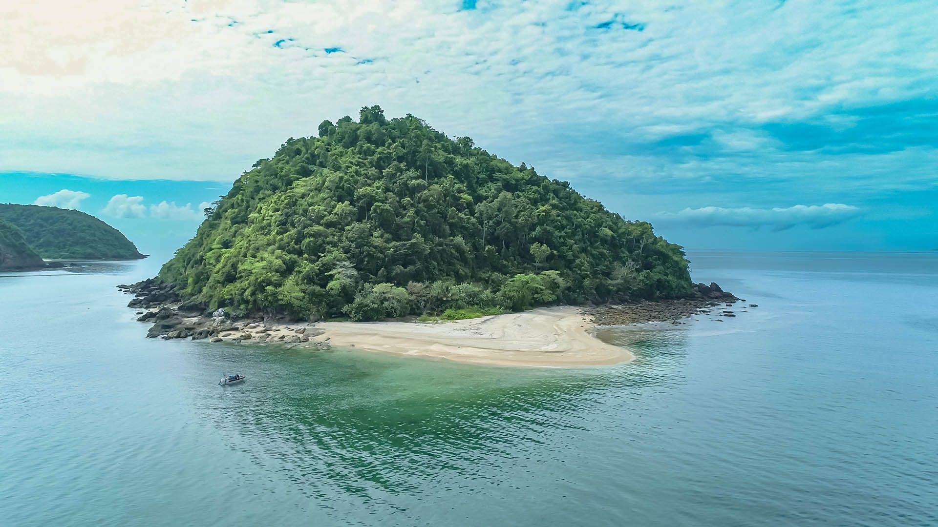
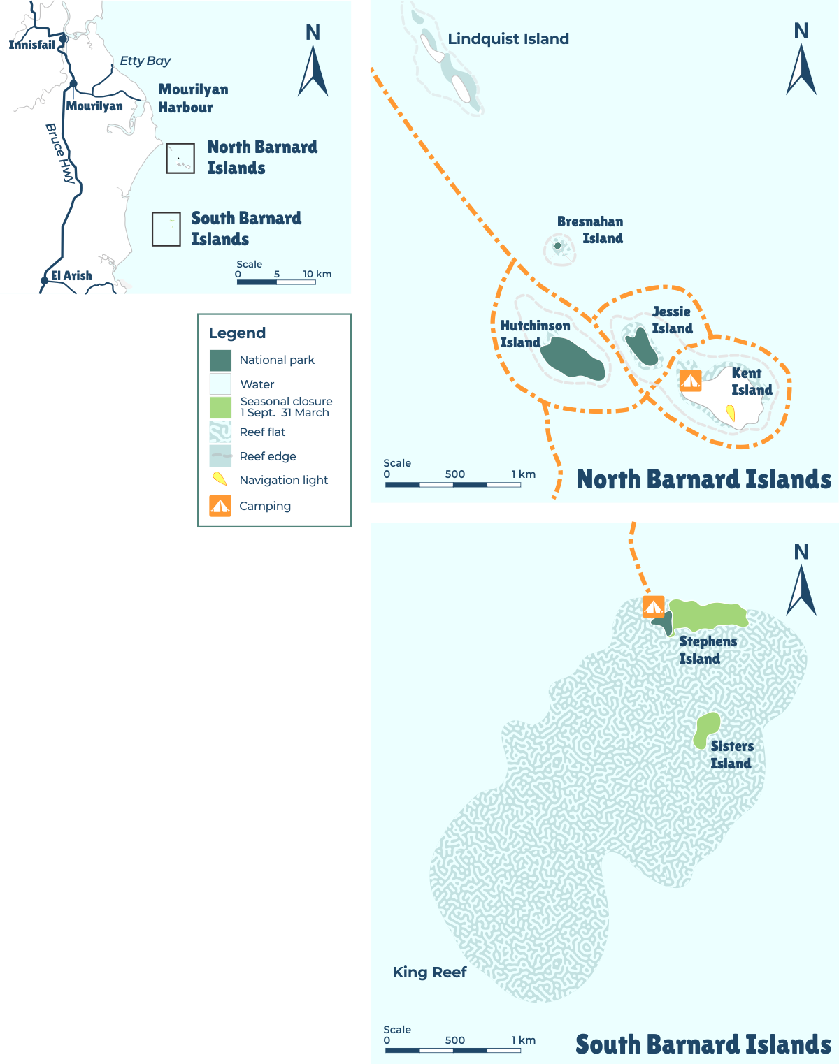
Barnard Island Group National Park
Barnard Island Group National Park is a protected area in the Cassowary Coast Region. The islands feature outstanding rock formations and diverse landforms including shallow reefs, sand spits, beaches and dense rainforest-clad slopes.
They also host important seabird rookeries. Six species of terns have been found nesting in the southern Barnard Islands, and twenty-three species of forest birds have a habitat here. The park is part of the 'sea country' of the Mandubarra Traditional Owners. In the late 1800s, a bech-de-mer (sea cucumbers) fishing settlement was built on Sisters Island. Six boats and a large Aboriginal workforce occupied the island until the settlement was lost in a cyclone in 1890.
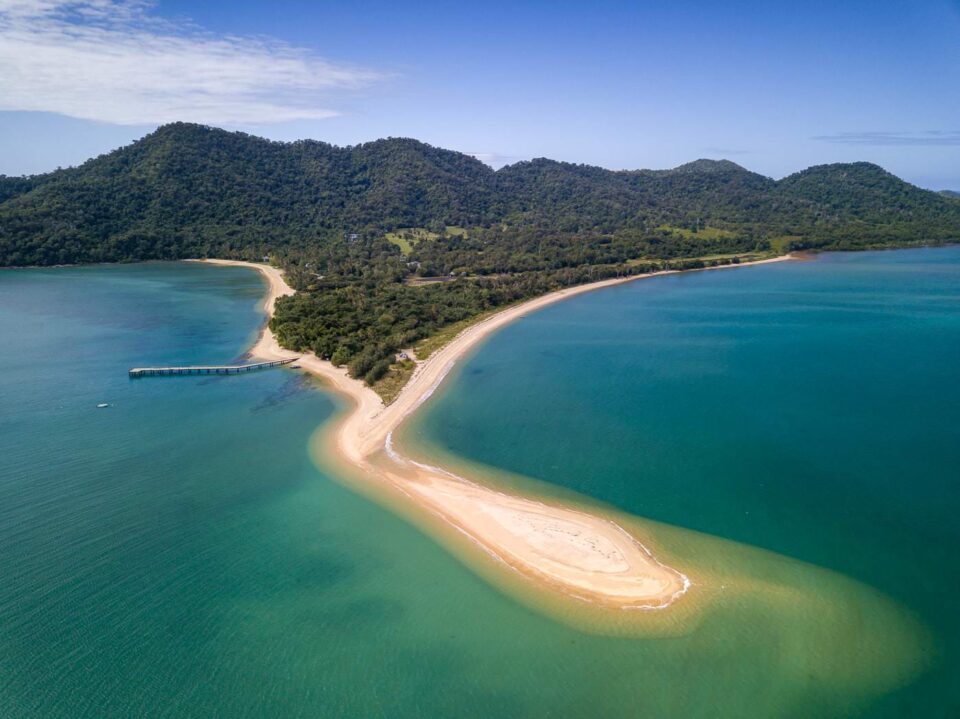
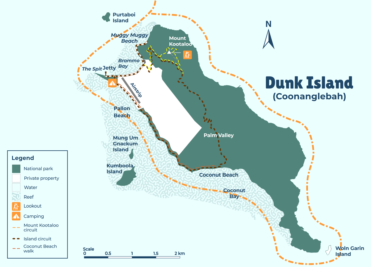
Dunk Island
Dunk Island is an island within the locality of Dunk in the Cassowary Coast Region. It lies 4 kilometers off the coast, opposite the town of Mission Beach.
The island is part of the Family Islands National Park and is in the larger Great Barrier Reef World Heritage Area. Dunk Island is surrounded by coral reefs and has a diverse population of birds. The Bandjin and Djiru peoples once used the island as a source for food. Europeans first settled on the island in 1897. Dunk Island was used by the Royal Australian Air Force during World War II. In recent years, the island and its resort facilities have been adversely affected by both Cyclone Larry and Cyclone Yasi.
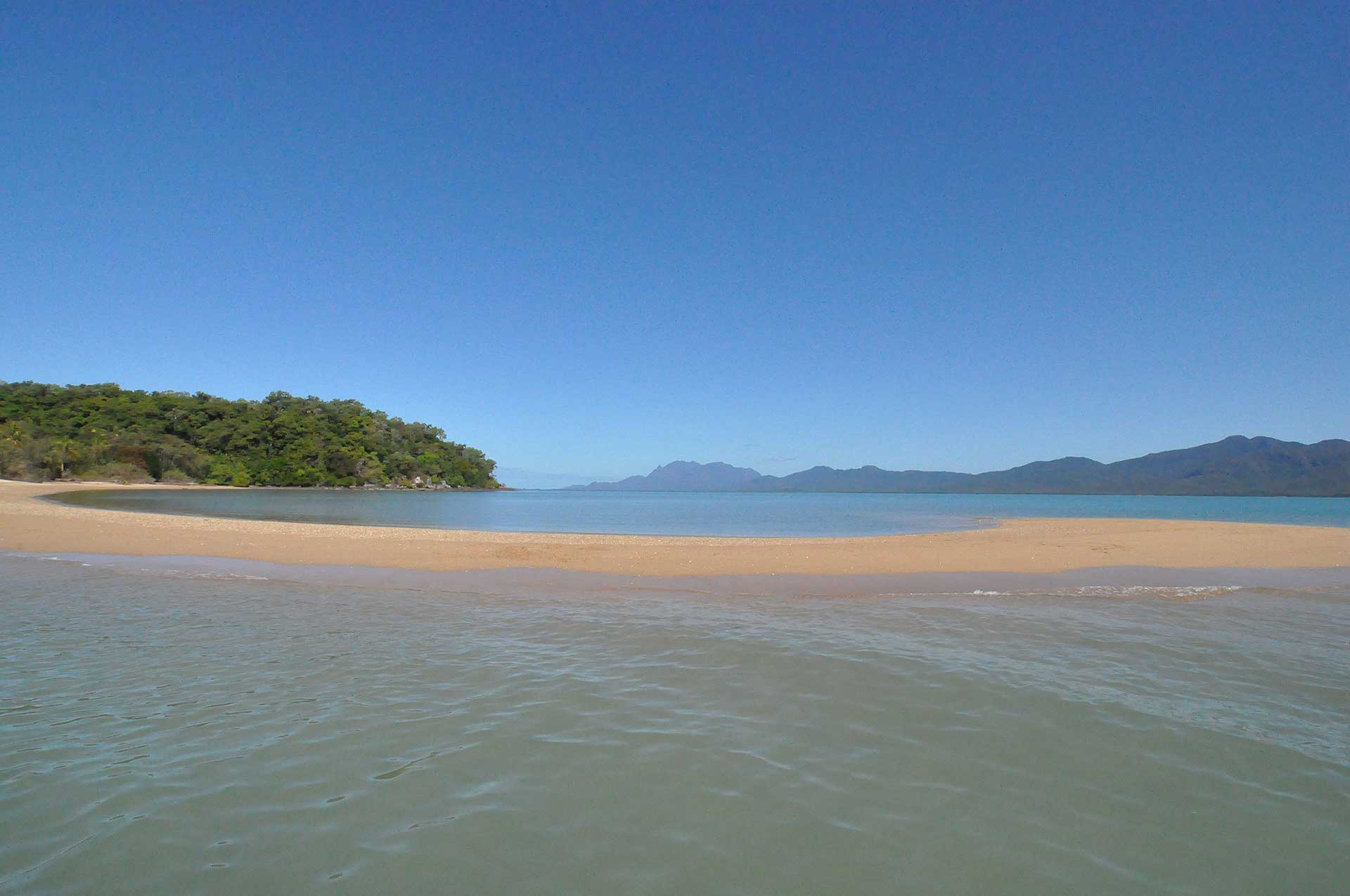
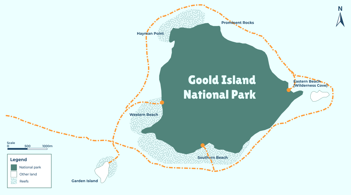
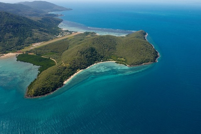
Goold Island
Goold Island is a tropical island off Cardwell, Queensland. It is a tall, forested hill with granite outcrops, eucalypt woodlands, and sandy beaches.
The island is part of the Goold Island National Park, which is located in the Cassowary Coast Region. Camping on the island and boating nearby are popular activities. The Bandjin and Girramay Aboriginal people are the Traditional Owners of Goold Island. They welcome visitors to their country, which is a land of lush vegetation where today there are reminders of their special culture, including middens and fish traps.
Great Palm Island Group
Part of the Family Islands National Park, the The Great Palm Island Group is a collection of 16 islands located off the coast off Lucina Point on the Cassowary Coast, Queensland, Australia.
The group is also known as the Greater Palm group and was originally named the Palm Isles. The largest island in the group is Great Palm Island, which is also known as Palm Island. The island is known for its Aboriginal community, the legacy of an Aboriginal reserve, the Palm Island Aboriginal Settlement (also known as "the Mission"). The original inhabitants of the island (and others in the group) were the Manbarra people, also known as the Wulgurukaba. The island has an area of 55 km² (21 sq mi) and is situated 65 kilometers (40 miles) northwest of Townsville. The ocean surrounding the island is part of the Great Barrier Reef Marine Park, where extraction and fishing are regulated. Its principal dive sites boast 1,100 of the 1,500 species of fish on the reef. The local waters are a fisherman's playground and home to the most sought-after reef fish species in the world.
Pelorus Island
Pelorus Island is the northernmost island of the Great Palm Island group, located 800 meters north of Orpheus Island. It covers an area of about 400 hectares (990 acres) and is surrounded by spectacular fringing reefs that can be accessed by snorkeling right off the beach. Camping on the island and boating nearby are popular activities.
Orpheus Island
The island is about 12 kilometers long and varies from one kilometer to 2.5 kilometers wide. It is hilly, has rocky headlands and sandy beaches and covers an area of 1300 hectares. Orpheus Island is a continental island composed of volcanic rocks that formed around 280 million years ago. The Aboriginal (possibly Nyawaygi) name for this island is Goolboddi Island. The island is part of the Orpheus Island National Park, which is managed by the Queensland Parks and Wildlife Service. The park is open to visitors 24 hours a day. Orpheus Island is known for its exclusivity and unspoiled beauty.
Iris Point
Iris Point is a dive site located at the northern tip of Orpheus Island. The reef wall at Iris Point extends in places down to 15 meters in depth, and visibility usually ranges from 6 to 10 meters.